

Defense and Military

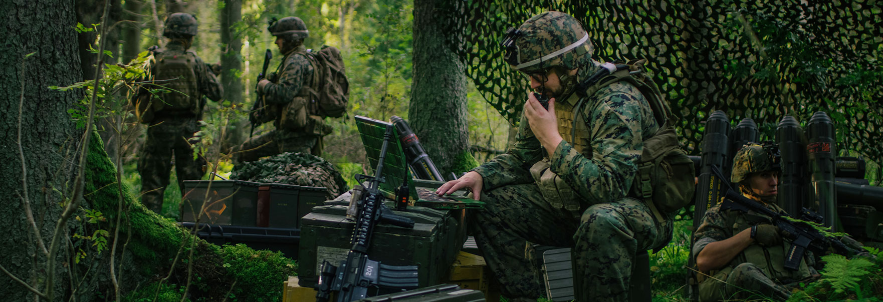
National security and defense is one of the fields in which satellite imagery data is most utilized. Satellites operate from remote locations off Earth, making them ideal for observing and managing military and defense installations and activities around the world. It also plays an important role in identifying affected areas and obtaining meaningful geographic information in crises such as conflicts.
Sample Imagery
Applications

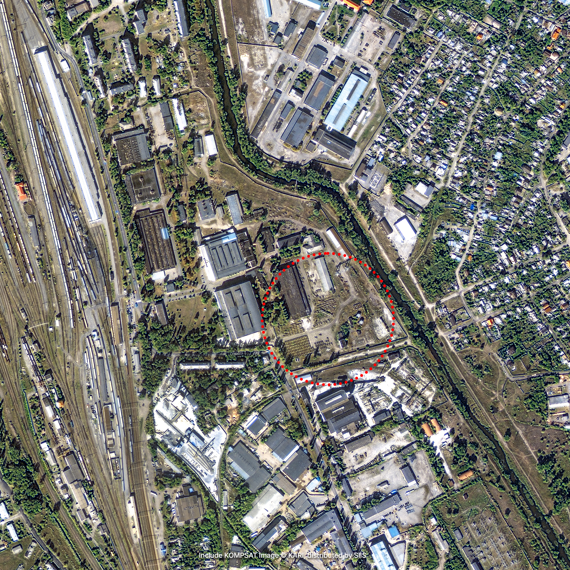
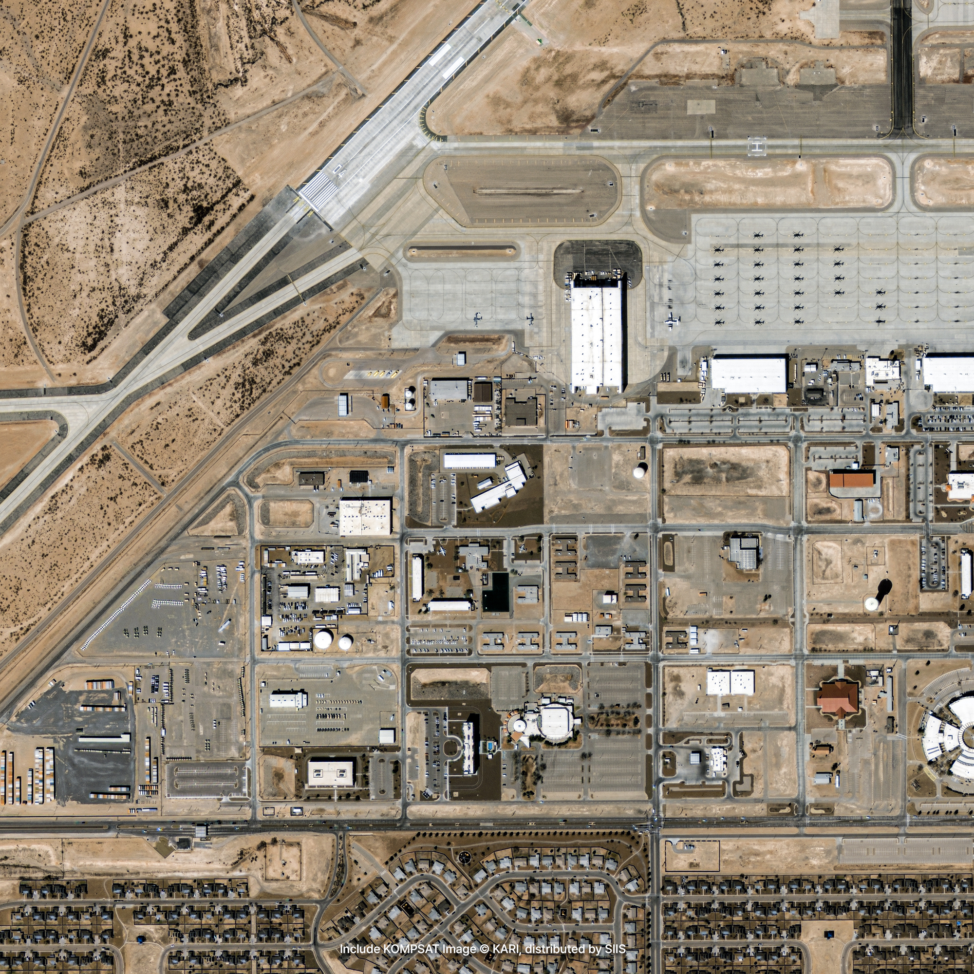
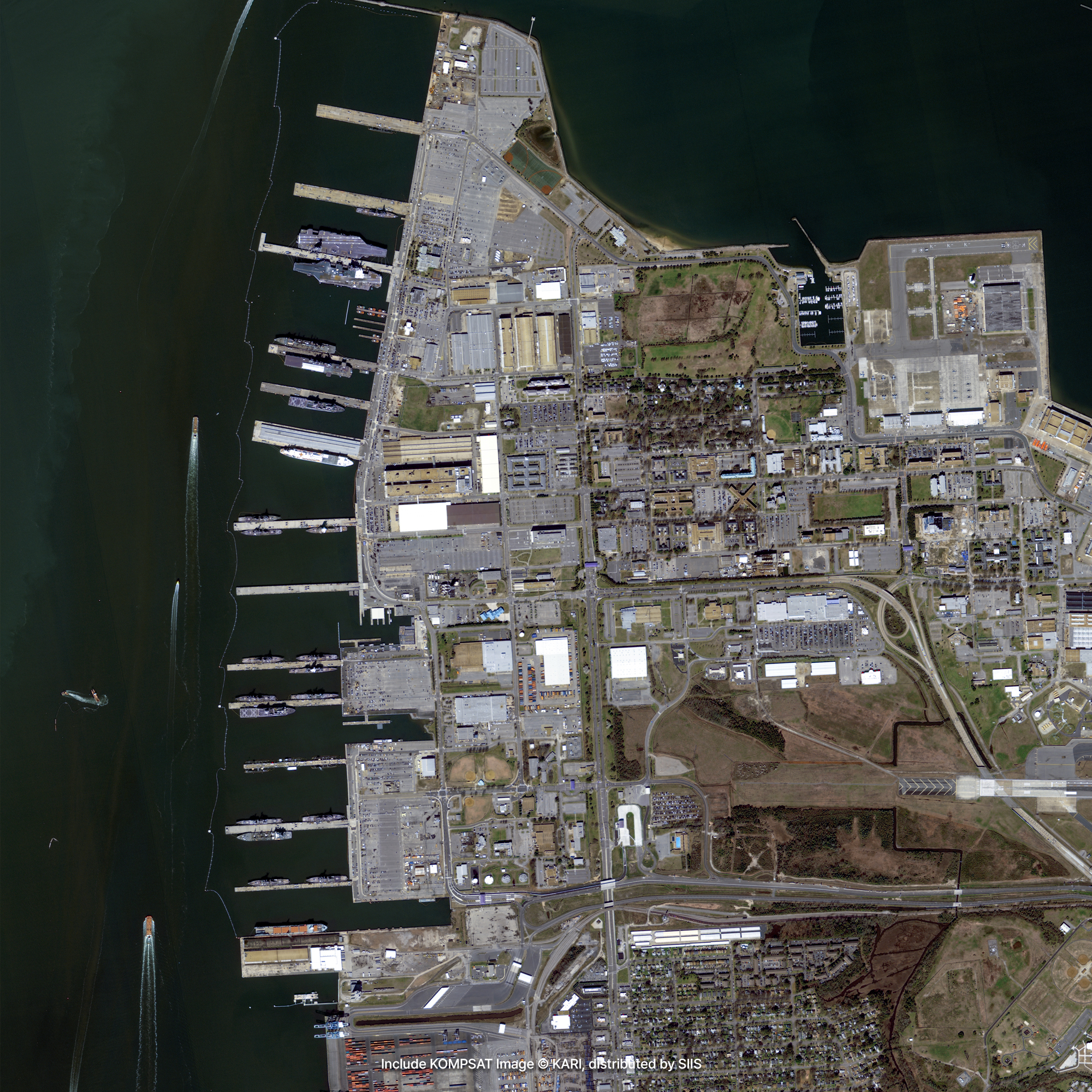
Identifying Military Facilities and Activities
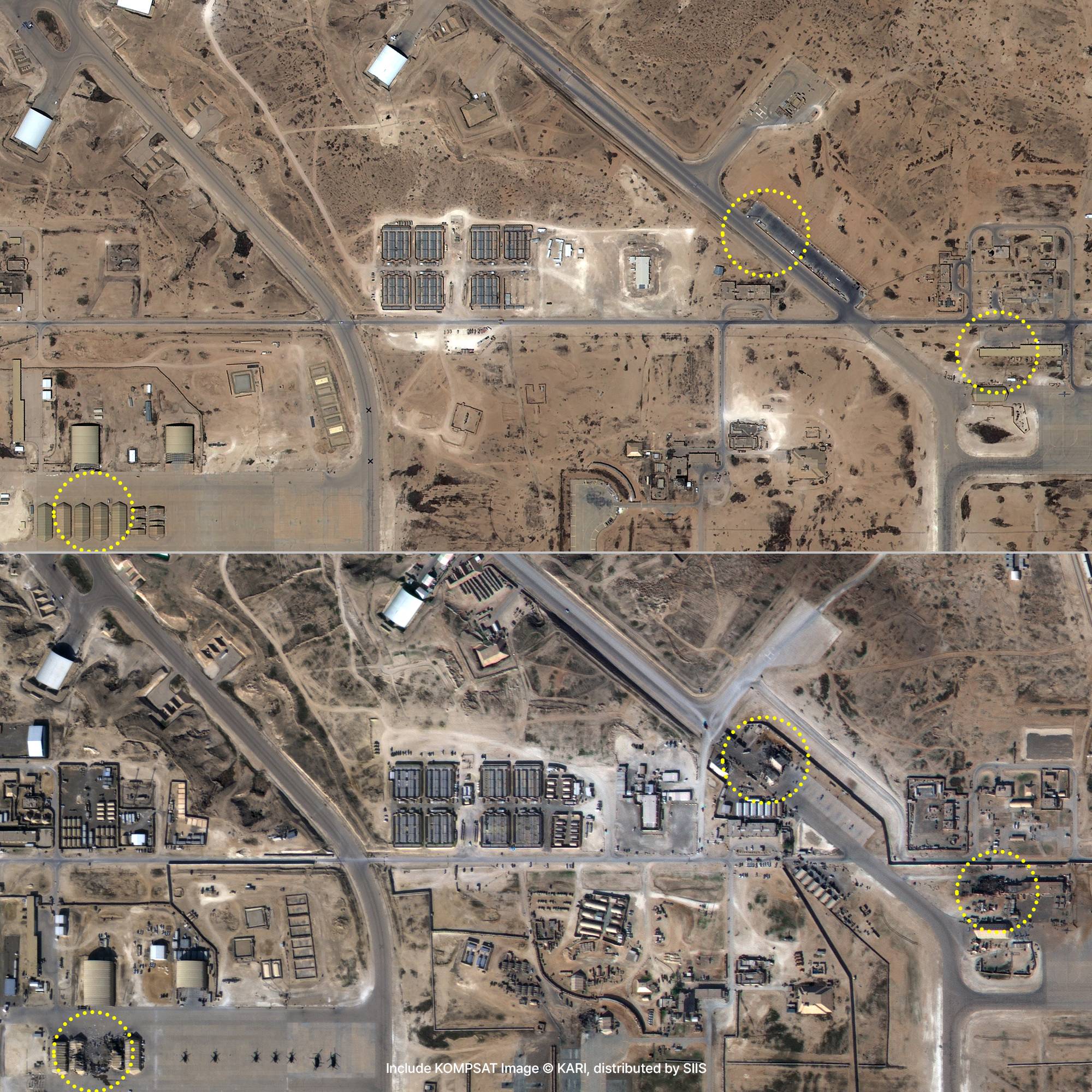
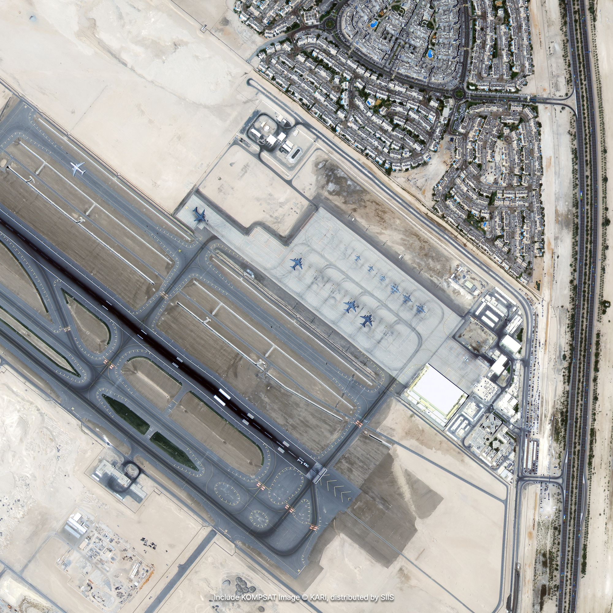
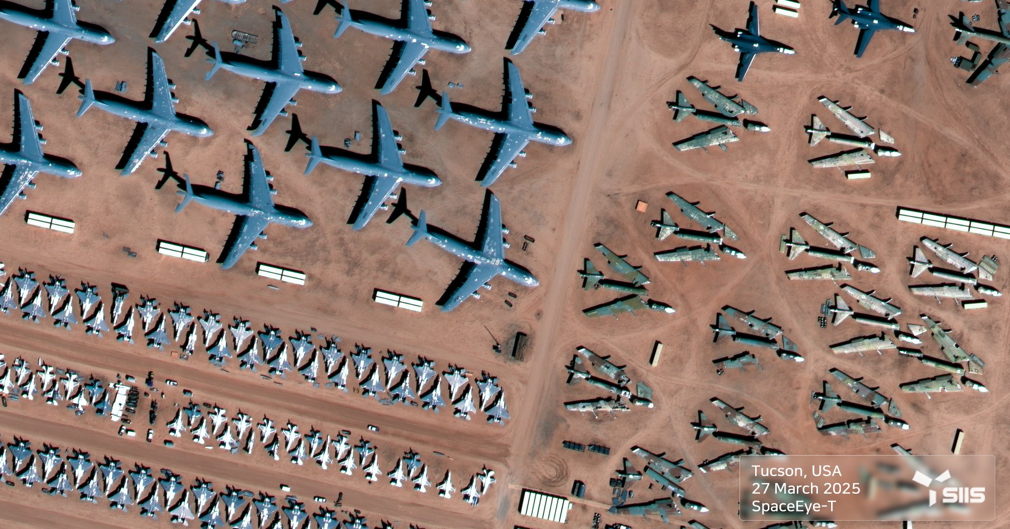
Earth observation satellite images can be used to provide up-to-date information on military infrastructure and logistics facilities, or military activities, and to observe wide geographic areas in regional conflict situations. In particular, it is useful for quickly identifying damage in conflict areas. The situation or performance of a missile base can be evaluated through photo reconnaissance, infrared detection, weather observation, and distance measurement with satellite images. And a crisis situation can be monitored or predicted by tracking the movement and deployment of military units.

Acquiring Military and Geographic Information
By statistically analyzing the reflection characteristics of the ground surface shown in each band of the satellite image and grouping pixels with similar characteristics into the same category, the type of land surface covering the country can be classified into cities, forests, rivers, rice fields, grasslands, and bare fields. In addition, the 0.4m high-resolution satellite images provided by KOMPSAT are clear enough to figure out the type and size of aircraft or ships, structural information of related facilities, and large and small geographical features of military hubs and their surroundings. This military and geospatial information is not only used for reconnaissance, but can also be provided to government agencies and defense companies to develop a variety of defense and security related solutions.
Get in Touch
Send us your inquiries, and we’ll respond promptly.
ADDRESS : 21, Yuseong-daero 1628beon-gil, Yuseong-gu, Daejeon, Republic of Korea 34054TEL : 042-341-0401
Copyright 2025 SIIS. All rights reserved. Admin