





Oil and Gas Facilities

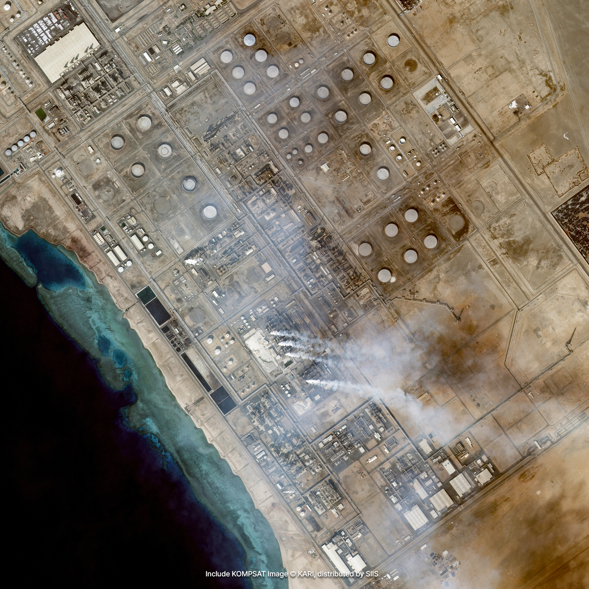
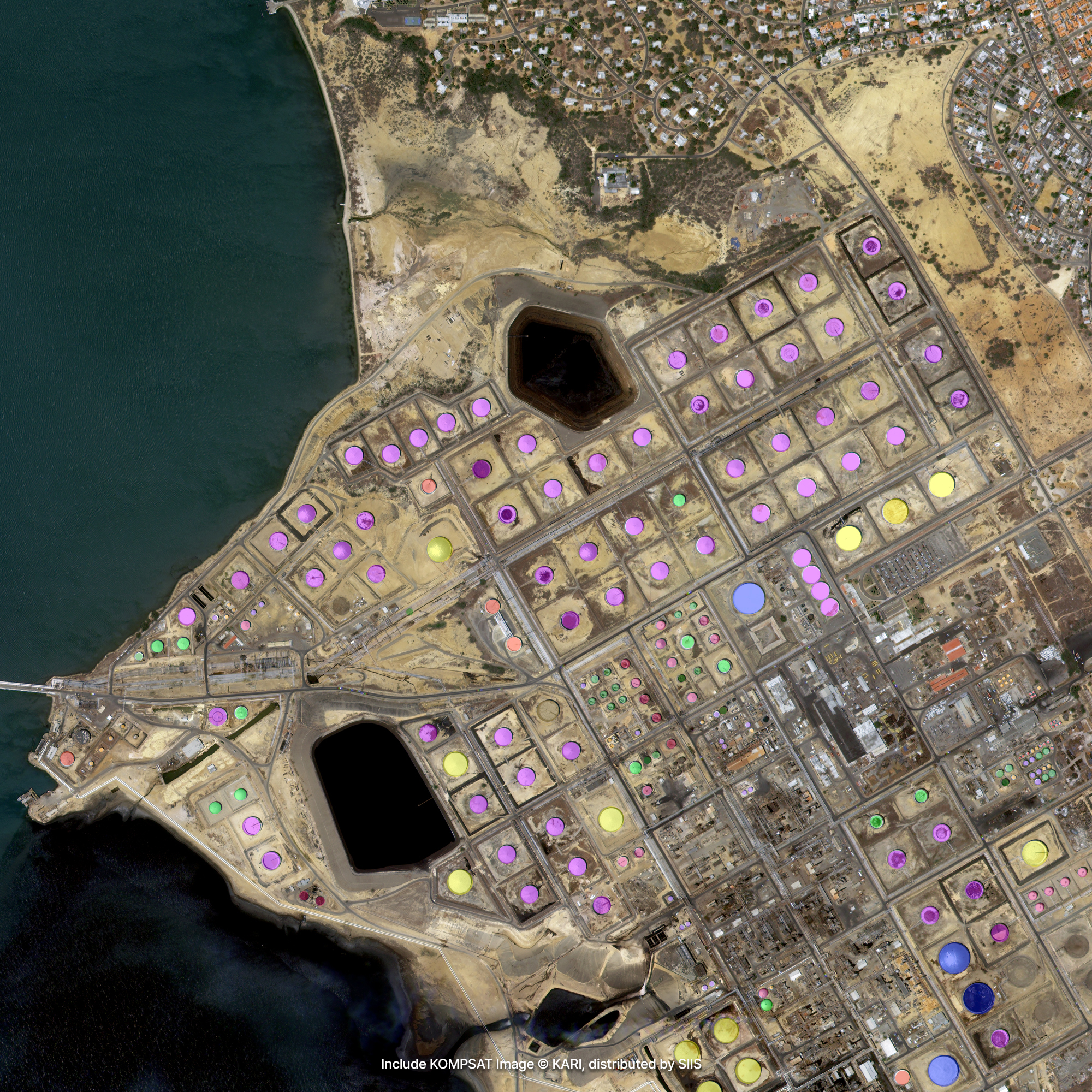
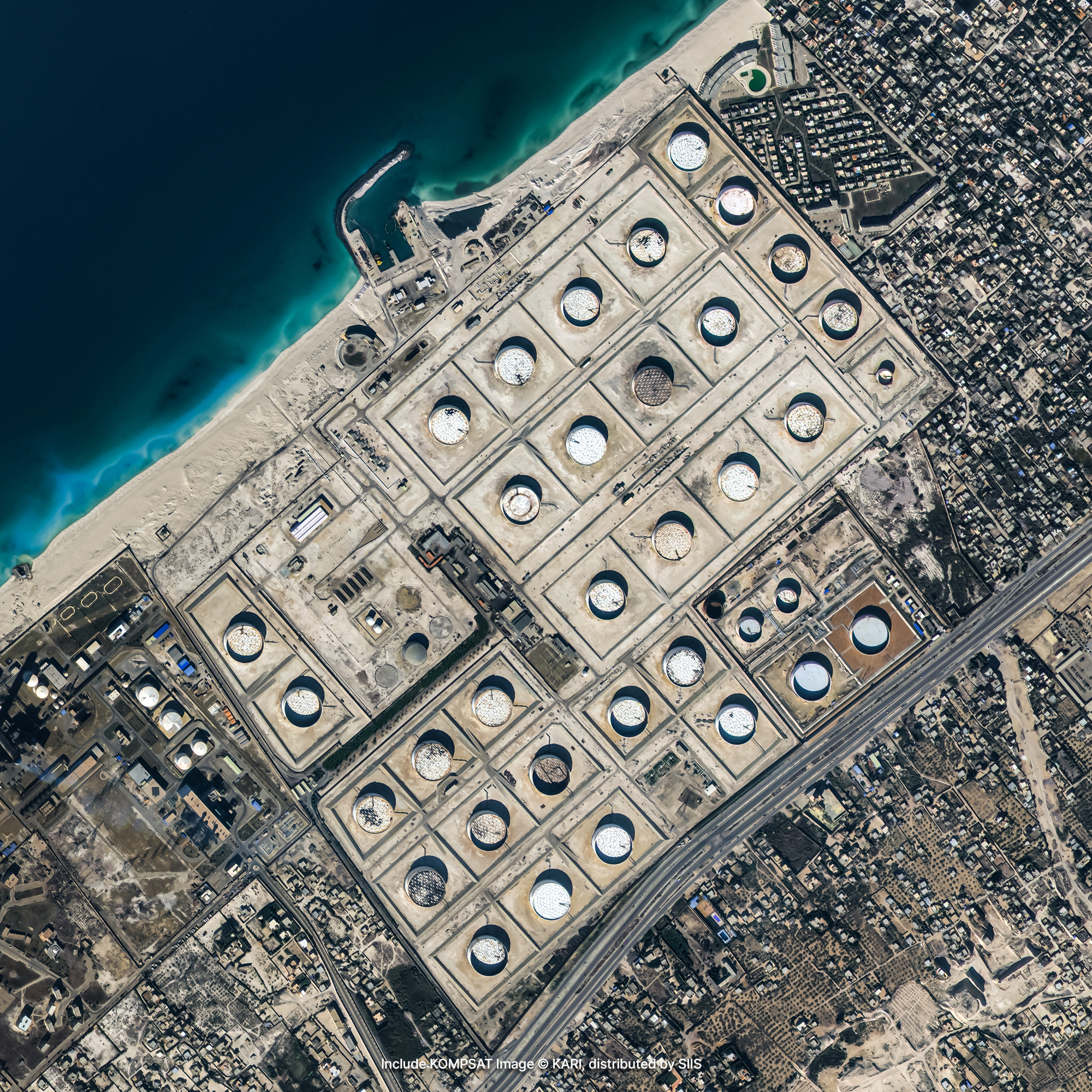
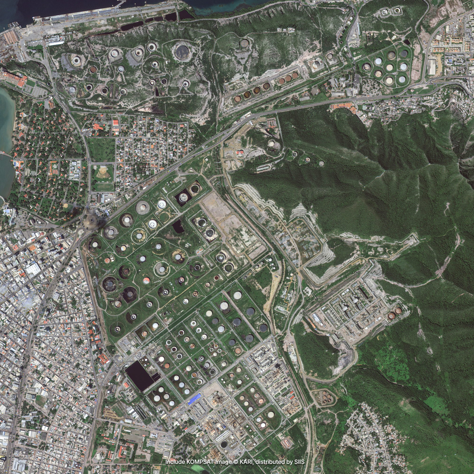
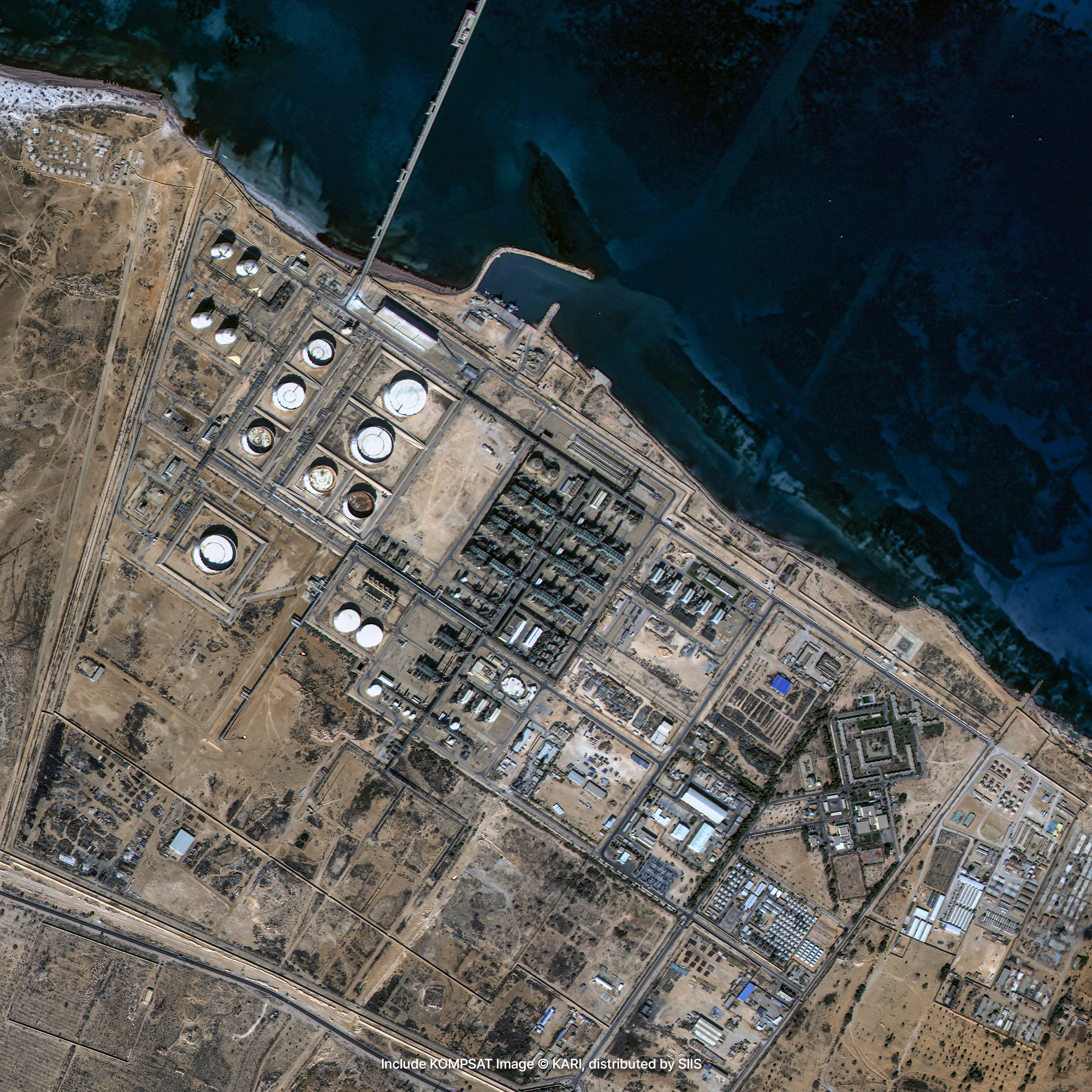
Satellite imagery can be used to predict the amount of oil remaining in crude oil tanks, as well as the construction progress of oil storage and gas facilities. By collecting and regularly observing shadow data from the inside and outside of crude oil tanks captured in satellite imagery, it is possible to understand how the amount of oil stored in the tank changes.
Sample Imagery

Applications

Estimating Crude Oil Volume
The volume of oil remaining in floating-roof storage tanks can be accurately estimated by analyzing the external and internal shadow data regularly captured via our VVHR and VHR imagery. By continuously tracking these oil stockpiles and conducting comparative before-and-after analyses, organizations can predict market-appropriate supply pricing and global crude oil demand, while monitoring real-time inventory levels and daily fluctuations. Utilizing this precise satellite-based technique, financial intelligence firms have achieved unprecedented accuracy in crude oil stockpile analysis, drawing significant attention from commodity traders and the global financial industry.

Facility Site and Construction
You can identify optimal locations for new oil and gas facilities through precise topographic surveys powered by our VVHR and VHR imagery, while simultaneously auditing environmental impacts by tracking factory waste or chemical leakages in nearby river systems. In addition, routine monitoring over the same industrial zones enables you to track construction scales, manage asset expansion, and establish manufacturing indicators for infrastructure like crude oil tanks. Moreover, this consistent tactical observation helps operators quickly pinpoint specific structural anomalies requiring maintenance, ensuring a timely and proactive response to facility repairs.
Get in Touch
Send us your inquiries, and we’ll respond promptly.

ADDRESS : 21, Yuseong-daero 1628beon-gil, Yuseong-gu, Daejeon, Republic of Korea 34054TEL : 042-341-0401
Copyright 2025 SIIS. All rights reserved. AdminFAMILY SITE