

Disaster Monitoring

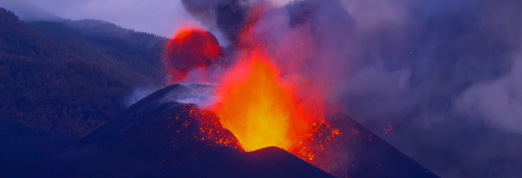
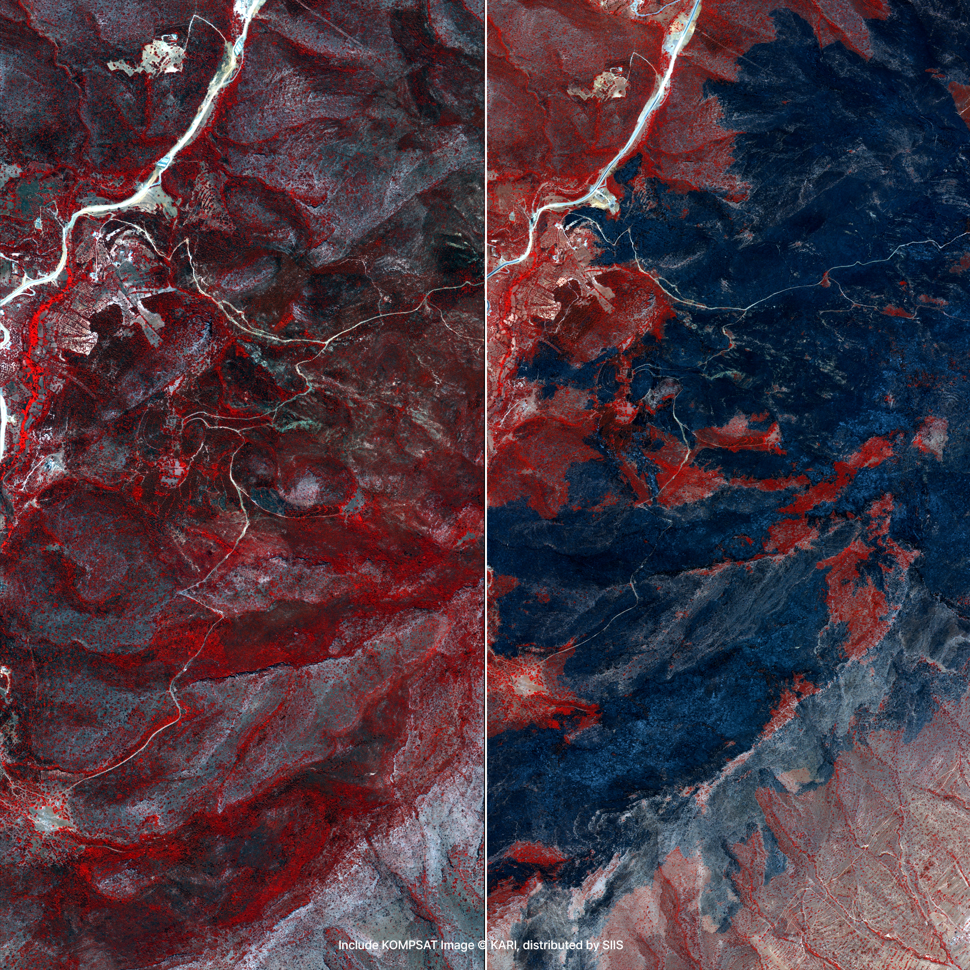
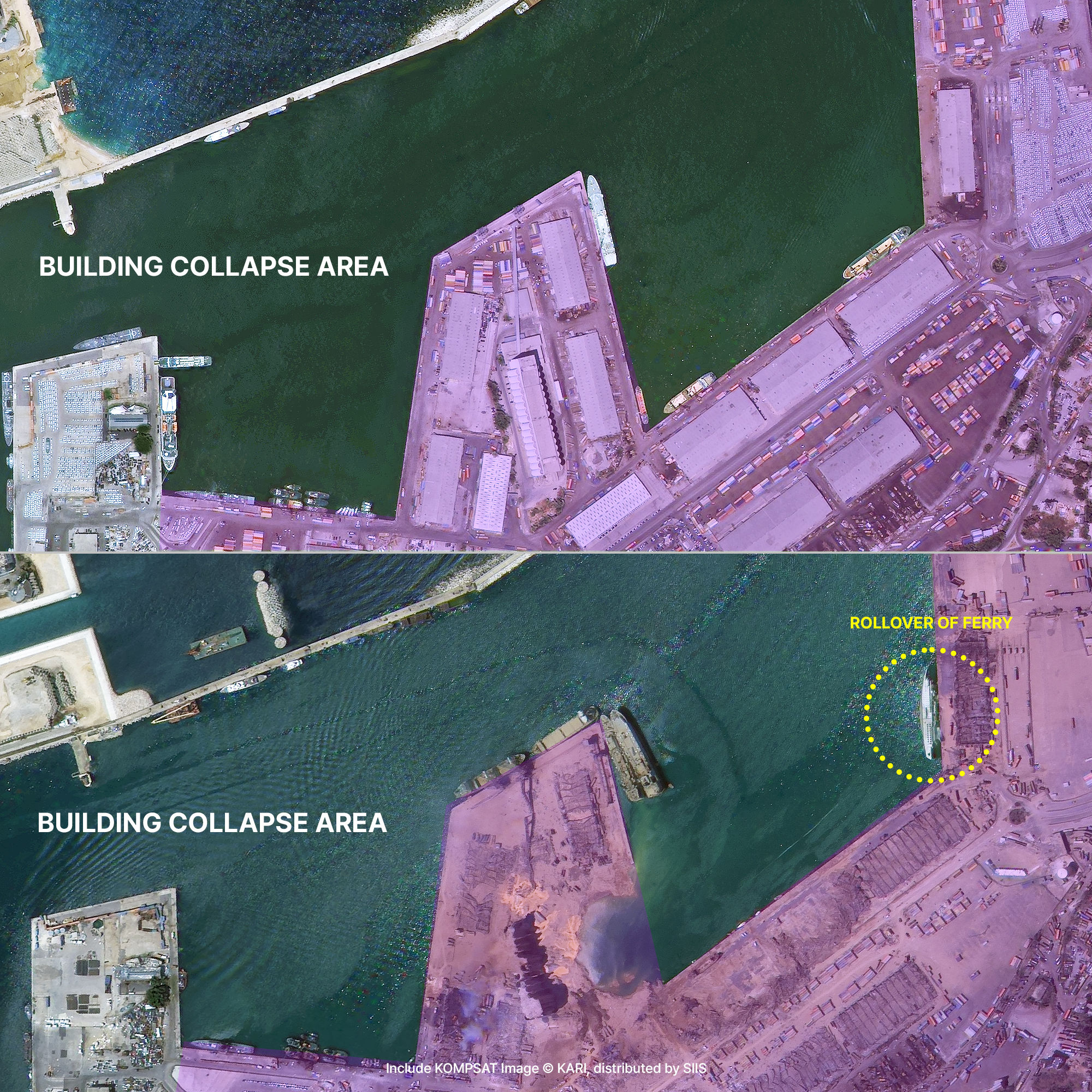
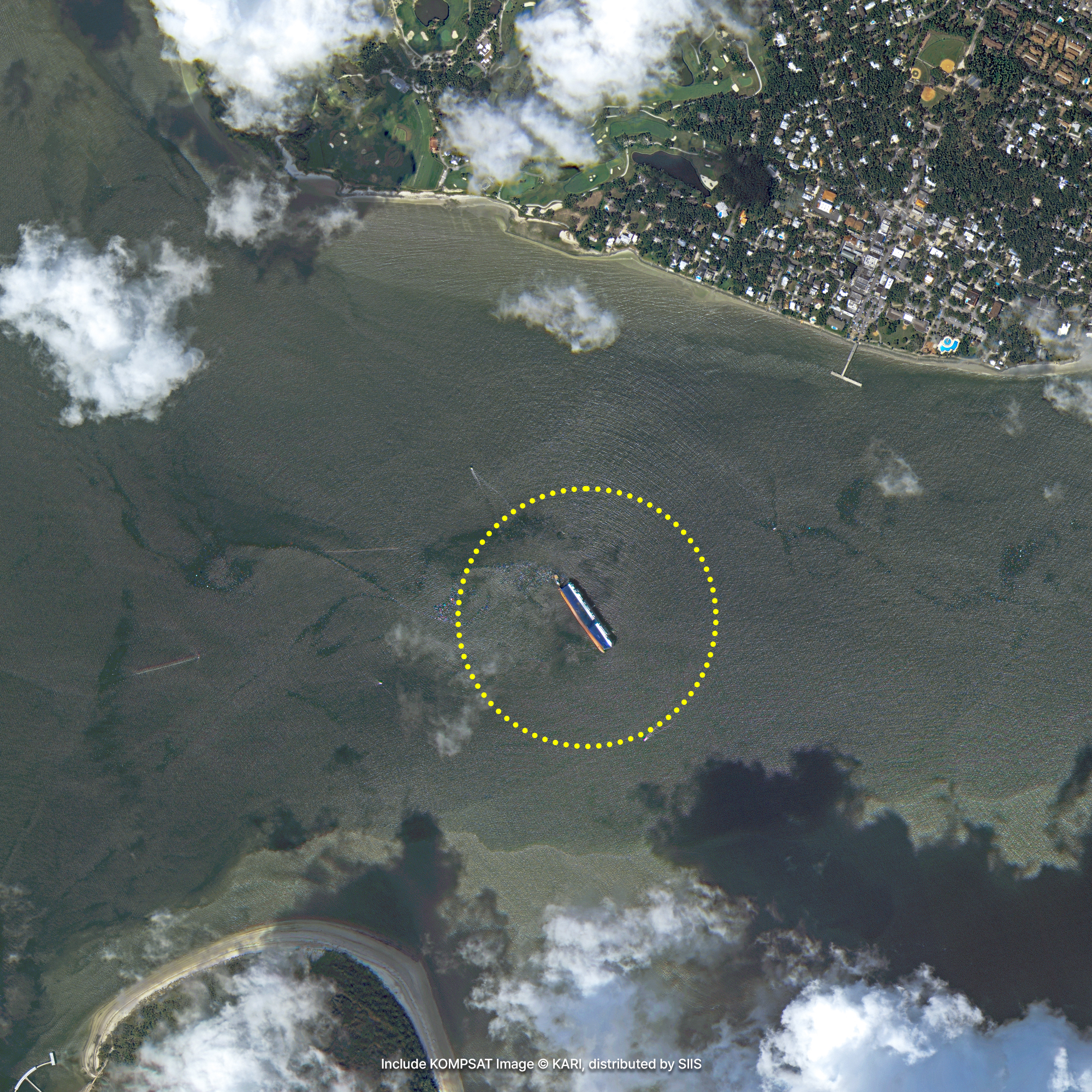
Satellite imagery enables prompt response to natural disasters by monitoring situations at a glance that are difficult to observe by humans or drones such as wildfires, earthquakes, volcanic eruptions, floods, and so on. You can also capture the before-and-after condition of a disaster site and use it in a recovery plan.
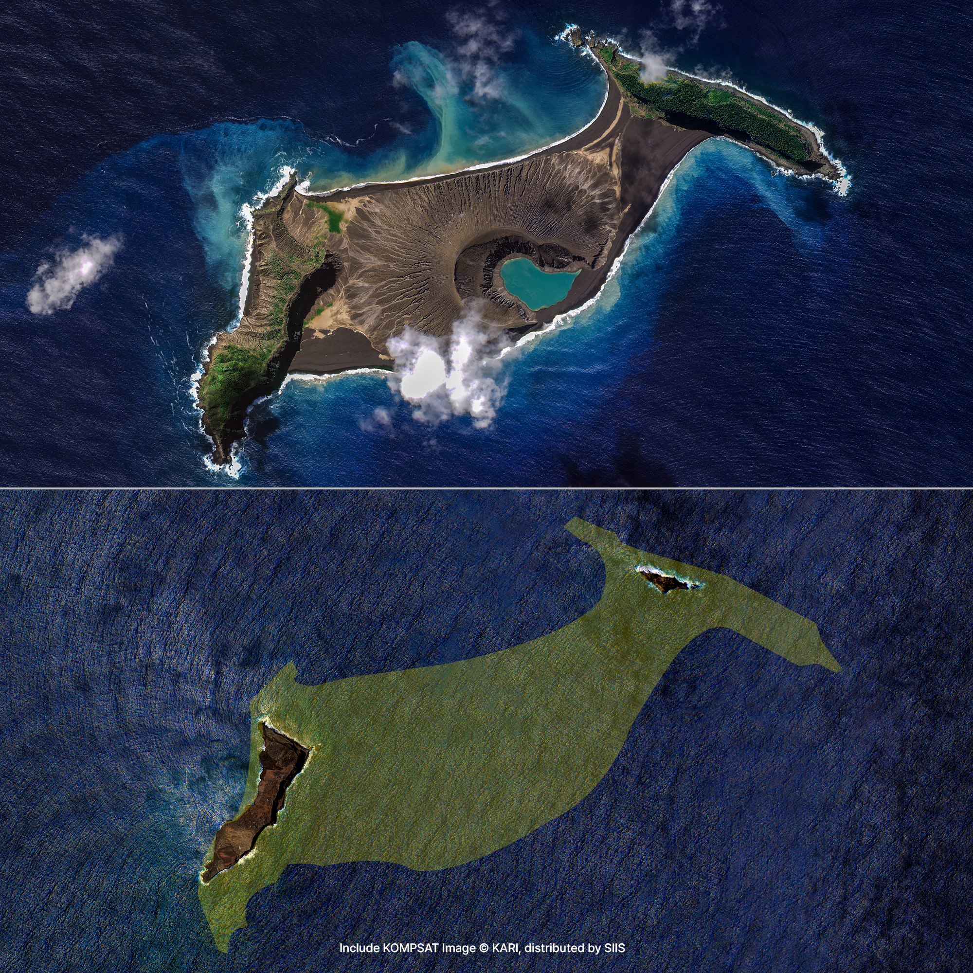
Sample Imagery


Applications

Identifying Global Disasters
KOMPSAT actively provides data through the International Charter on Space and Major Disasters activities in the event of a global disaster. The Charter is an international cooperation program that supports the identification of damage and restoration activities by quickly capturing the affected area with satellites in the event of a large-scale disaster such as earthquake, typhoon, heavy snowfall, fire, or oil spill. Currently, 17 space development organizations owning earth observation satellites are participating, and Korea Aerospace Research Institute (KARI) is representing Korea. An average of more than 500 KOMPSAT images per year are used to analyze damage caused by floods, earthquakes, and volcanic eruptions in Southeast Asia, Africa, and South America. KOMPSAT is also used to determine the status of damage from wildfires in Korea as well as overseas, and thus is of great help in national disaster management.

Climate Change and Environmental Issues
The Group on Earth Observation (GEO), as an intergovernmental cooperative organization, has established the Global Earth Observation System of Systems (GEOSS) to achieve the public goals of climate change response, disaster reduction, and sustainable development. In Korea, the Ministry of Science and ICT is in charge of the Korean Earth Observation Organization (K-GEO), and the Korea Aerospace Research Institute (KARI) acts as a leading member. They are expanding the base of earth observation satellite data utilization and securing competitiveness in the global market through KOMPSAT images.
Get in Touch
Send us your inquiries, and we’ll respond promptly.
ADDRESS : 21, Yuseong-daero 1628beon-gil, Yuseong-gu, Daejeon, Republic of Korea 34054TEL : 042-341-0401
Copyright 2025 SIIS. All rights reserved. Admin